Help & FAQ
Everything MGRS Cardinal can do, and how to do it. Badges show which plan includes each feature: Free Pro Premium
- Getting started
- MGRS grid lines
- Map styles
- Pins and details
- Grid search
- Drawing and measuring
- Go to: navigate to a pin
- Compass and map rotation
- Red night mode
- Military unit symbols
- Teams: shared map, positions and chat
- Saving, KML and spreadsheets
- Account, plans and billing
- Troubleshooting
Getting started Free
Move the map and read the grid under the yellow crosshair in the grid box at the bottom. No account needed.
How do I get the grid of a place?
Drag the map until the crosshair is on the spot. The grid box shows it live. Tap the grid to copy it, or the pin button to drop a pin there.
How do I choose 6, 8 or 10 digits?
Use the 10 · 8 · 6 buttons in the grid box. 10 digits = 1 m, 8 = 10 m, 6 = 100 m. See How to read MGRS.
What are the buttons on the right?
The tool rail, from the top: move the map, drop a pin, draw a line, circle, rectangle or area, military symbol, text label, layers (KML), spreadsheet import, team, grid lines, map style, your location, compass, red night mode, and About. A 🔒 means the tool is part of a paid plan: tap it to see which.
Can I get more space on my phone?
Yes. Tap › at the top of the tool rail to slide it away (swipe left from the right edge to bring it back). Tap the small bar on the grid box, or swipe it down, to shrink it to a slim strip.
How do I go to my location?
Tap the crosshair-circle button in the tool rail and allow location access. Your position shows as a blue dot.
MGRS grid lines Free
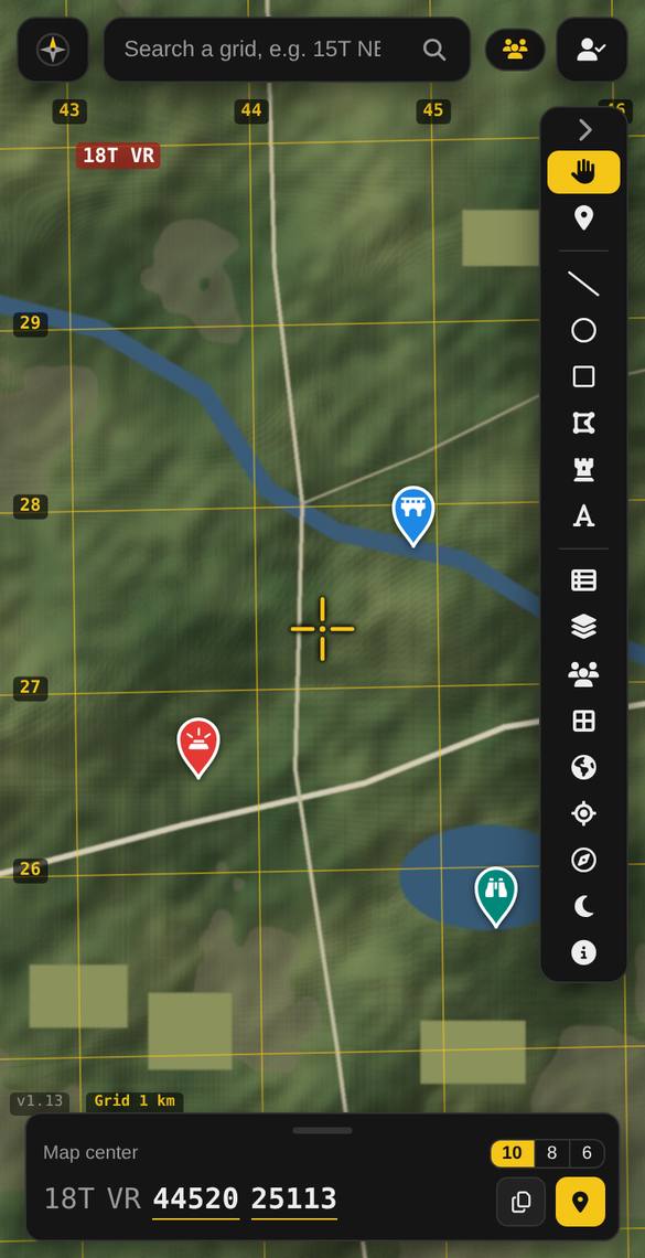
Tap the grid button (▦) to draw the MGRS grid on the map. The spacing follows your zoom: 100 km, 10 km, 1 km and 100 m. The numbers along the top and left edges are read like a paper map, and the top-left corner shows your zone and square (e.g. 18T VR).
Why are the lines slightly tilted?
They’re true UTM grid lines, calculated for each zone, so they tilt a little and bend where two zones meet, exactly like a printed military map.
Map styles FreePro
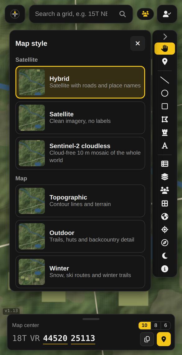
Free accounts use Hybrid (satellite with roads and names). Pro unlocks every style: Satellite, Sentinel-2, USGS aerial (United States), Topographic, Outdoor, Streets and Winter, plus roads and place names on top of satellite with an opacity slider.
What does the brightness slider do?
It dims the map so your drawings and pins stand out.
Pins and details FreePro
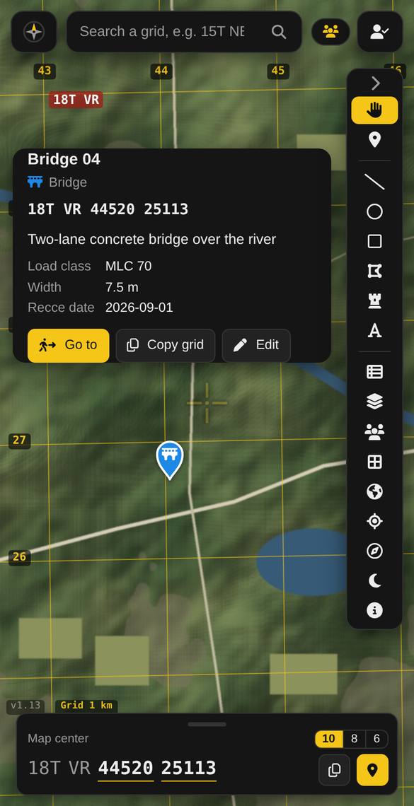
Drop a pin with the pin tool, or the pin button in the grid box. Tap a pin to see its grid and details, copy the grid, or start Go to.
Pro adds 13 military pin types (bridge, minefield, OP, obstacle, casualty…), colours, a description, and your own fields (e.g. “Load class: MLC 70”) with + Add field.
Grid search Pro
Type a grid in the search box in any format: 15TNB9087653845, 15T NB 90876 53845, 4 to 10 digits, or a latitude/longitude. The map jumps there and marks the spot.
Drawing and measuring Pro
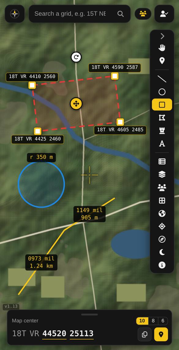
Draw lines, circles, rectangles and areas. Each shows its measurements on the map: distance and bearing for every line segment, radius for circles, and the grid of each corner for rectangles.
How do I move, rotate or resize a shape?
Select it, then use the handles on the map: the yellow ✥ moves it, the white ↻ rotates it, and the white squares resize or reshape it. Rectangles keep their angle when resized.
Mils or degrees? Grid, true or magnetic north?
Pick in the shape’s panel, or once for everything under Account → Personal information → Preferences. Mag N uses the World Magnetic Model for your location, so you can follow the bearing with a compass.
Can I set an exact size?
Yes: open ▸ Exact size in the panel to type a radius, a centre grid, or side lengths.
Can I add text on the map?
Yes, with the A tool. You can resize, rotate, bold and add a background to text labels.
Go to: navigate to a pin Pro
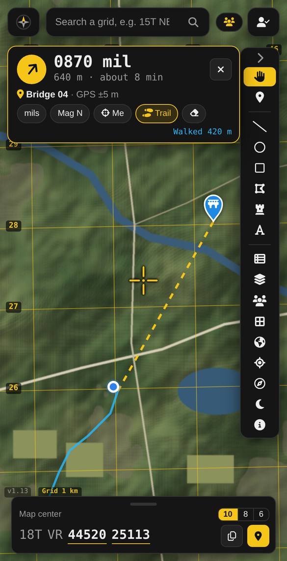
Tap a pin, then Go to. The card at the top shows the bearing and distance from you to the pin, your GPS accuracy, and an arrival time once you’re moving. Everything updates as you walk, and the phone vibrates when you arrive.
What is the blue line?
Your trail: where you walked, with the total distance. Tap Trail to hide or pause it and the eraser to clear it. It stays on your device only.
Does it work with the screen off?
No: like all web apps, it pauses when the phone locks, so it keeps the screen on while you navigate.
Compass and map rotation Pro
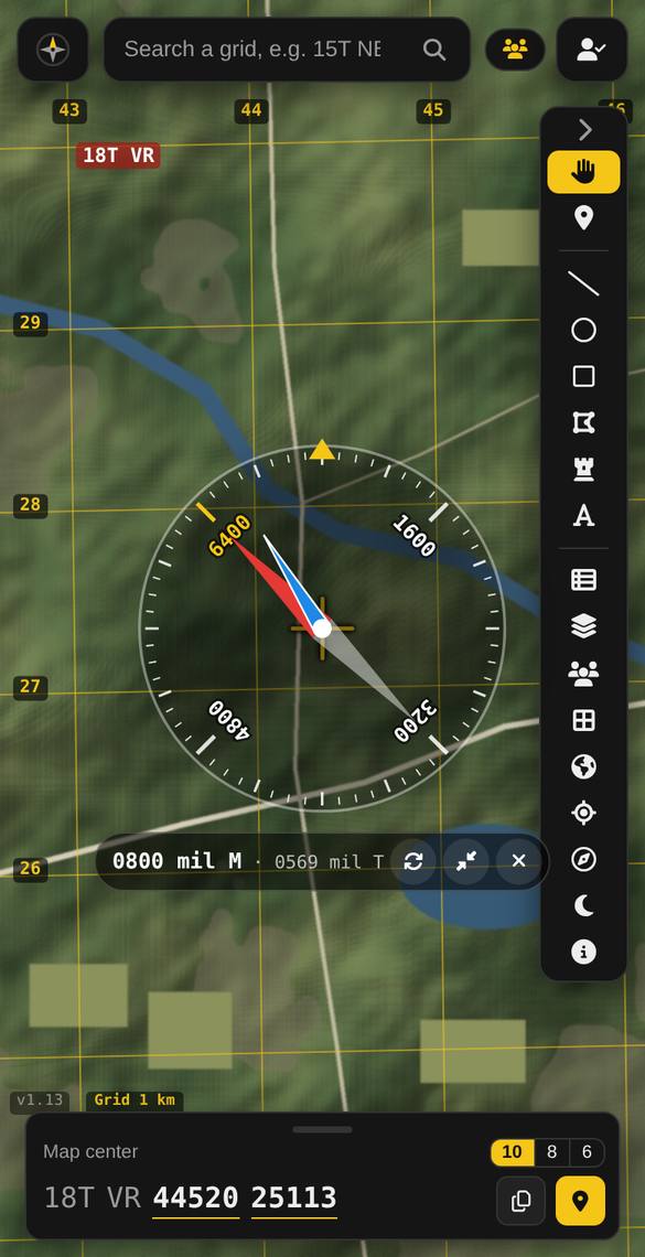
Tap the compass button for a mil compass centred on the crosshair: the red needle points to magnetic north (6400), the blue needle to true north. Read your heading at the yellow mark at the top.
How do I make the map turn with me?
In the compass strip, tap ↻: the map turns so what’s in front of you is at the top. On phones, you can also twist the map with two fingers (all plans). Tap the round N button to go back to north-up.
The compass looks wrong
Phone compasses are disturbed by metal, vehicles and electronics, and are unreliable indoors. Go outside, move the phone in a figure-8 a few times to calibrate it, and compare with a real compass.
Red night mode Pro
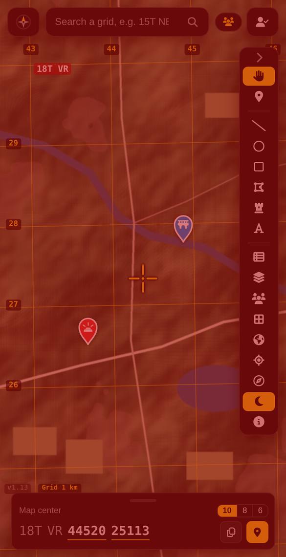
Tap the moon button to tint the whole screen red and dim it, to protect your night vision and keep your light low. The Red and Dim sliders let you adjust it. For the darkest screen, also lower your phone’s brightness.
Military unit symbols Premium
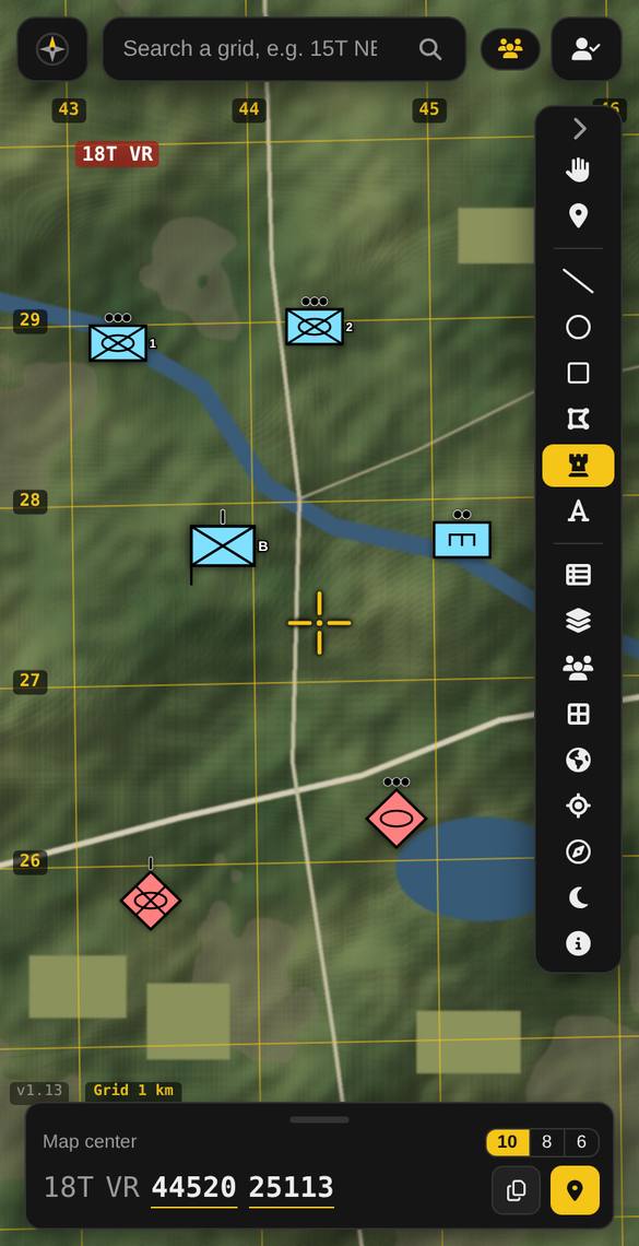
Place NATO-style unit symbols with the ♜ tool: friendly, hostile, neutral or unknown; infantry, armour, recce, artillery, engineer, anti-armour, air defence, aviation, medical, signals, supply or HQ; dismounted, mechanized or motorized; a size mark from team to division; an HQ staff; and a label such as “2” or “A/1”.
Can I change a symbol after placing it?
Yes: select it and change anything in the panel. The next symbol you place starts with your last settings.
Teams: shared map, positions and chat ProPremium
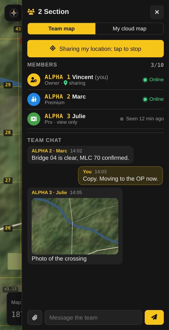
A Premium member can create a team of up to 10 and share an invite code. Everyone sees the same map, live.
- Premium members can draw, share their live position, chat and send photos and files.
- Pro members can view the team map and read the chat.
- Free accounts can’t join teams.
How do call signs work?
The team owner gives each member a call sign, an icon and a colour. They appear in the member list, in chat and on live positions.
How does location sharing work?
It’s off until you tap Share my location. Your position updates about every 15 seconds while the app is open, and only Premium members of your team can see it.
Can I stop people from moving my pins?
Yes: lock an item from its panel. Only you and the team owner can then change it.
Are photos private?
Photos are shared only with your team. Their GPS location data is removed before upload. Anyone can report a message, and the team owner can delete any message.
Saving, KML and spreadsheets ProPremium
- Free Maps are saved on your device automatically.
- Pro Save as KML for Google Earth, ATAK or GIS, and open KML files back in.
- Premium Cloud sync: your personal map on all your devices.
- Premium Spreadsheet import: load up to 3,000 grids from Excel or CSV as pins.
Account, plans and billing Free
Where are my account settings?
Tap the person icon. Account shows your plan, renewal date and team. Personal information has your nickname, email, password, preferences (units, angles, north) and Delete my account.
How do I cancel or change my plan?
Person icon → Manage subscription. You keep your paid features until the end of the year you paid for. See the refund policy: every yearly payment has a 7-day money-back guarantee.
Can I install it like an app?
Yes. On Android/Chrome: About panel → Install the app. On iPhone: open the site in Safari → Share → Add to Home Screen.
Troubleshooting Free
My location doesn’t show
Allow location access for the site in your browser settings, and turn on your phone’s location services. Accuracy is best outdoors.
I don’t see the latest version
Press Ctrl + Shift + R on a computer, or close and reopen the app on a phone. The version number is at the bottom-left of the map.
I didn’t get an email
Check your spam folder. Some work and government email systems block outside messages: use a personal address if possible.
Something else isn’t working
Contact us and include your version number and your device. We usually reply within 2 business days.