MGRS Cardinal: the live MGRS grid map
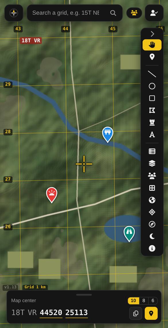
MGRS Cardinal is a map app for the Military Grid Reference System (MGRS), the grid coordinate system used on military and many topographic maps. Move the map, and the grid reference under the crosshair updates instantly, at 6, 8 or 10 figures. It helps people learn and practise map reading, plan routes, navigate to a point, and share precise positions with their team.

No account is needed to use the map. Sign in to sync your maps between your computer and your phone, join a team, or subscribe.
What is MGRS?
MGRS divides the world into squares and gives every point a short reference like 18T VR 44520 25113: the grid zone, the 100 km square, then how far right (east) and up (north) the point is. It’s faster and less error-prone to read out than latitude and longitude. Learn how to read an MGRS grid.
What you can do
Read any grid, live Free
The grid under the crosshair at 6, 8 or 10 figures, tap to copy. Grid lines from 100 km down to 100 m, labelled like a paper map. Drop pins and read their grid. Works in any browser and as an Android app.
Plan on your computer, use it on your phone Premium
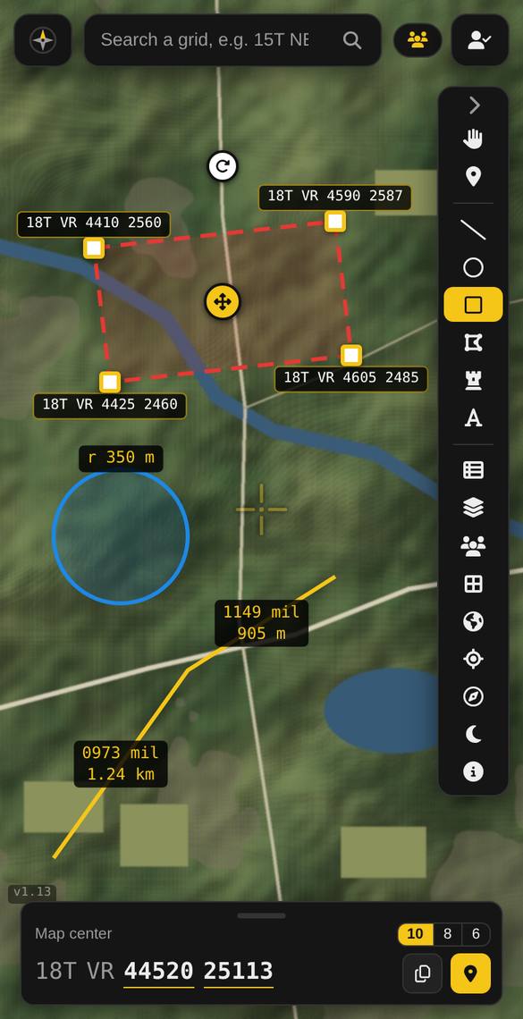
Sign in at mgrscardinal.com on your computer and plan on a big screen: pins, routes, search areas, unit symbols, PDF map overlays. Open the app on your phone with the same account and it’s all already there, instantly. Changes made on either side show up on the other within seconds, and on your whole team’s phones too when you plan on a team map.
Measure and plan Premium
Bearings and distances in mils or degrees, from grid, true or magnetic north. Lines, circles, rectangles and areas with measurements and corner grids. NATO-style unit symbols, PDF map overlays, light and moon data (BMNT, EENT, sunrise, sunset), elevation and recent satellite imagery.
Navigate to a point Premium
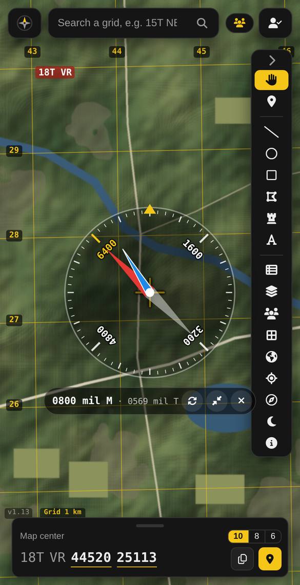
Go to any pin with a live bearing, distance and arrival time, a big walking display and your walked trail. A mil compass shows true and magnetic north. Red night mode protects night vision.
Work as a team Premium
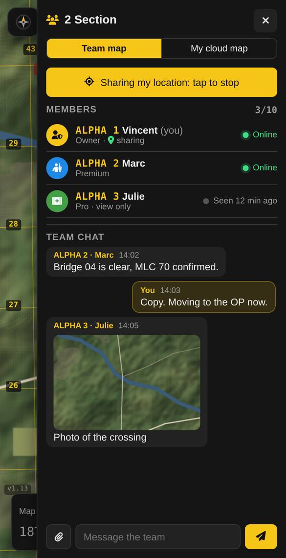
Shared team maps for up to 10 people, with call signs, optional live positions (only for people who choose to share), and team chat with photos.
Who it’s for
Cadet instructors and cadets learning map reading, hunters and hikers, search and rescue volunteers, airsoft and milsim players, and soldiers and veterans training on their own time. See the pages for cadets, hunters, search and rescue and military training.
MGRS Cardinal is a navigation aid. Always carry a map and compass where safety matters. It is an independent app, not affiliated with the Department of National Defence or the Canadian Armed Forces, and must not be used for classified or operational information.
Plans
Free: the live grid, grid lines, pins and the satellite hybrid map, with no account needed. Premium: $9.99 CAD a year, or $24.99 CAD once for Lifetime, for everything above. See the terms and the refund and cancellation policy.
Your account and your privacy
You can create an account with your email and a password, or with Sign in with Google. With Google sign-in, MGRS Cardinal only receives your name, email address and profile picture, and uses them only to create your account, show your name in the app and contact you about your account. We never access your Gmail, Contacts, Drive or other Google data, we don’t sell your information and we don’t show ads. Your location is used on your device and is only shared with your team if you turn on location sharing.
Read the full privacy policy, including what we receive from Google. You can delete your account at any time.
Who makes MGRS Cardinal
MGRS Cardinal is developed by Vincent Cardinal, an independent developer in Alberta, Canada. Questions, feedback or privacy requests: support@mgrscardinal.com or the contact page.
Try it now: free, no account needed
Open the map, move the crosshair, and read your first grid.
Open MGRS Cardinal Privacy policy Terms of service